More Pennsylvania Adventures - 9/2/2023
This morning Brian, Shawn and I continued our weekend road trip by first visiting the almost abandoned town
of Centralia.
It was about a twenty minute drive from our hotel to this near-ghost town in eastern Pennsylvania. Its
population declined from 1,000 in 1980 to four residents in 2021 because a coal mine fire has been burning
beneath the borough since 1962. It is now the least-populated municipality in Pennsylvania.
In 1992 all of the real estate in the borough was claimed under eminent domain and condemned by the
Commonwealth of Pennsylvania. State and local officials reached an agreement with the then seven remaining
residents on October 29, 2013, allowing them to remain in Centralia until their deaths, after which the rights
to their houses will be taken through eminent domain. Centralia's ZIP Code was discontinued by the Postal
Service in 2002.
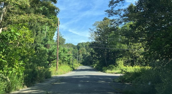
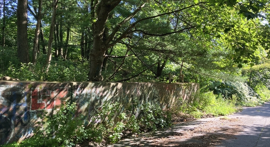
The streets of the town all seem to still be here and the pavement is maintained in a relatively good state
considering there's basically no reason to. The abandoned lots are overgrown as nature is reclaiming the
town.
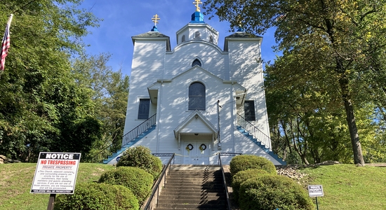
We drove to the northside of Centralia to see the town's last remaining church. The Assumption of the
Blessed Virgin Mary Ukrainian Greek-Catholic Church, on North Paxton Street, was built in 1911. The church
is nestled on a hillside overlooking the once-thriving town. We drove past and stopped to take pictures of
the church building. The church grounds are off limits, as it is clearly marked as no trespassing. It's
impressive that the church and grounds are so well maintained despite the nearby desolation.
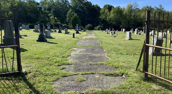
Next we visited the Odd Fellows Cemetery on the eastside of the town. This cemetery holds an important
place in Centralia's history, as it is near where the mine fire began in 1962. The landfill was just to the
north and adjacent to Odd Fellows Cemetery. The town landfill, which had previously been a strip mine, was
set on fire in an attempt to clean it up for Memorial Day. Unfortunately, the fire was not properly
extinguished, and it slowly made its way into the abandoned coal mines below the town. The fire is still
burning today.
A short drive away we visited Saint Ignatius Cemetery. The Saint Ignatius Church stood nearby, but only
the cemetery remains today. The cornerstone for the church building was laid July 18, 1869. The church
remained active as the fire slowly burnt below. Even as the residents of Centralia left, Saint Ignatius
continued to hold mass until the mid-1990s. At that time, there were too few parishioners to sustain
it. The last service was on June 25, 1995. The church building remained standing until November 1997
when it was finally razed.
Centralia has shown to be the most unique town I've ever visited. Brian, Shawn and I were now on the next
leg of our drive back to Pittsburgh now headed to Altoona.
Once we arrived in Altoona we visited the small Lakemont Park amusement park.

The park opened in 1894 as a trolley park and became an amusement park in 1899. It is one of only thirteen
trolley parks still operating, and the 8th-oldest amusement park in the United States.
Our first coaster of the day was Skyliner.
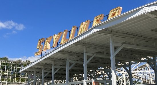
This roller coaster opened at Lakemont in 1987 after it was relocated from Roseland Park in Canandaigua, New
York, where it was built in 1960. Skyliner now borders the outfield of Peoples Natural Gas Field, home of
the Altoona Curve baseball team, next door. This feels like it was once a great coaster, but it is rough,
shaky and needs immediate maintenance. At the very least it could use an entire new coat of paint, but I
would be afraid that it would merely hide the need for more substantial renovations. It is the sketchiest
coaster I've ever been on.
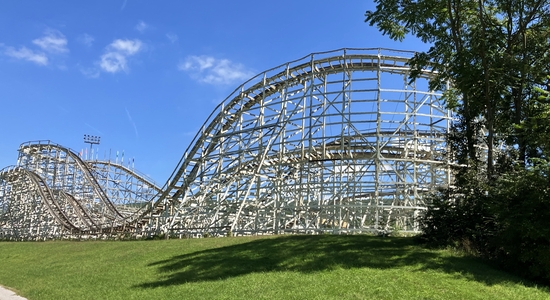
Next we rode the historic Leap The Dips.
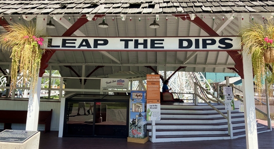
The coaster was built by the Federal Construction Company and opened to the public in 1902. It is the
oldest operating roller coaster in the world, the only side friction roller coaster in the United States and
believed to be the last surviving side friction roller coaster of the figure-eight variety in the world. The
track design became obsolete after World War I when side friction was supplanted by under-track mechanisms, which
offered better vehicle security and support for greater speeds. The ride was closed for all but two weeks in
2005, because of maintenance. The ride was also closed from 1986 to 1998 and brought back to life by a
fundraising effort. The ride is quite tame by modern standards with a height of 41 feet a maximum drop of
approximately 9 feet and maximum speed of 10 mph. It remains a popular attraction because of this coaster is
more of a scenic and nostalgic ride, providing a gentle and classic amusement park experience rather than the
thrilling drops and inversions found on contemporary roller coasters. Shawn, Brian and I all agree that the
coaster is rough and it needs a lot of love.
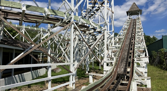
A few steps away from Leap The Dips was the C.P. Huntington Train.
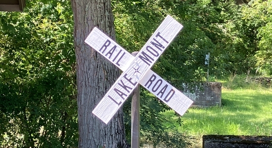
The three of us enjoyed the 5-minute train ride through the scenic woods and along Brush Run. And there
were nice views of the park and Skyliner.
From the park we drove a few miles west to the near outskirts of Altoona to visit Horseshoe Curve.
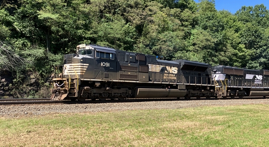
Horseshoe Curve is a railroad curve on the face of the Allegheny Mountains, roughly 2,375 feet long and 1,300
feet in diameter. Completed in 1854 by the Pennsylvania Railroad as a way to reduce the westbound grade to
the summit of the mountains, and replaced the time-consuming Allegheny Portage Railroad. Later owned
by Penn Central, Conrail, and then Norfolk Southern, Horseshoe Curve is now owned by the Norfolk Southern
Railway. Horseshoe Curve was added to the National Register of Historic Places and designated as a National
Historic Landmark in 1966.
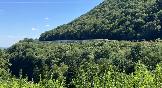
In 1879, the remaining part of the mountain inside the curve was leveled to allow the construction of a park and
observation area, the first built for viewing trains. This led to an increase of tourists and the Horseshoe
Curve becoming world famous. Shawn, Brian and I walked up 194 steps to the top viewing area and heard,
watched, and felt the great trains go by.
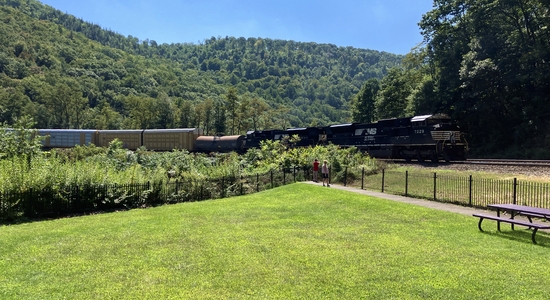
After taking in the sights and sounds of the curve we headed back to the car and onto the road back towards
Pittsburgh. As we drove along Shawn surfed the internet on his phone and saw that the Johnstown Flood
National Memorial was only 15 miles off of our intended drive. So we decided to take this small sidetrip.
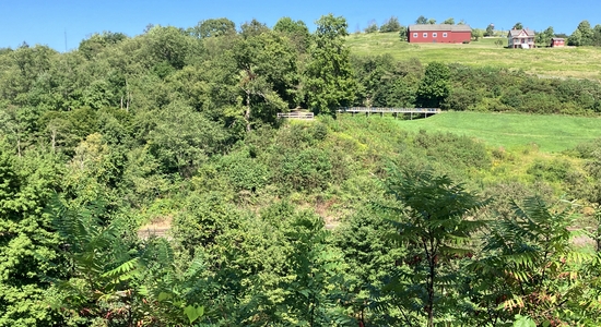
We drove to the South Fork Dam. Just a short walk from the car we walk onto the top of the southern
portion of the dam. We walked out the end of the dam. From here we could see across the large gap where
the majority of the once stood to the remaining portion on the northern side of the valley. In the valley
below runs the South Fork of the Little Conemaugh River. I stood there and tried to imagine the missing
portion of the dam stretching across between the two remaining pieces to get a sense of the dam in its entirety.
The South Fork Dam was originally built between 1838–1853 by the Commonwealth of Pennsylvania as part of the
canal system. The dam was 72 feet high and 931 feet long. Ownership of the dam later passed through
several parties, none of which maintained the dam in a manner that kept it in proper condition. On Friday,
May 31, 1889, after several days of unprecedented rainfall, the dam collapsed. The dam's rupture released
twenty million tons of water, which traveled at forty miles per hour, creating a sixty-foot-high wall of water
and debris that was propelled into the Little Conemaugh River Valley, where it flooded Johnstown fourteen miles
away. The flood killed 2,208 people.
We then returned to Pittsburgh to conclude our two day Pennsylvania adventure. I enjoyed our weekend
together. Hopefully this will be the first of many trips we take in the future.
Previous | Blog list | Next
|